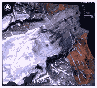
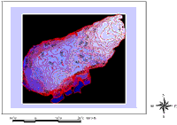
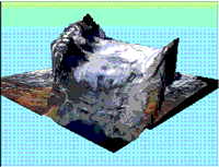
Aldegondabreen, aerial photo 1990
Aldegondabreen, aerial photo 1990
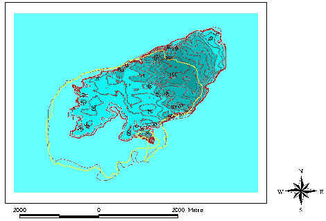
Radar profiles
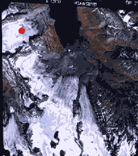
Radar measurements (RES) were collected on 5 longitudinal and 18 transversal profiles of total length 40 km covering the whole glacier area excluding the steep tongue. Most measurements were made with an interval 5 s, that corresponds to a distance between measurement points of about 10 m.
On 6 profiles in southern part of the glacier, where of hyperbolic reflections from englacial channel were recorded, the measurements were made with an interval 1 s.
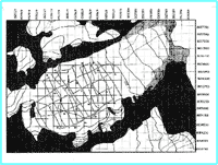
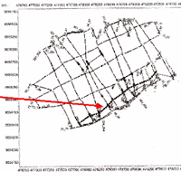
Map of 1936 with RES profiles 1999
Area of study
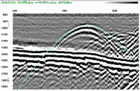
Hyperbolic reflections
Bedrock and internal reflections
The records clearly show the reflections from glacier bedrock and hyperbolic reflections presumably from englacial channels.
After RES data reduction the ice thickness and bedrock maps were constructed. Maximum ice thickness of the glacier is 216 m.
Bedrock map
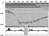
Original RES record with bedrock reflections
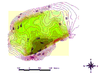
Ice thickness map
Englacial channel
Surface and volume changes
Airial photos of 1990 allows to build a digital elevation model (DEM) of glacier surface and surroundings.
Comparison with map of 1936 provides the information on glacier surface and ice volume changes.
| Aldegondabreen |
1936
|
1990
|
Change
|
| Area, km2 |
8.9328
|
7.6243
|
-1.3085
|
| Length, m |
5235
|
4305
|
-930
|
| Average thickness, m |
101
|
73
|
-28
|
| Volume, km3 |
0.905
|
0.558
|
-0.347
|
Therefore the average annual balance of Aldegondabreen in this period is -0.7 m/ yr (in water equivalent).
DEM with photo overlay
Glacier surface change 1936-1990
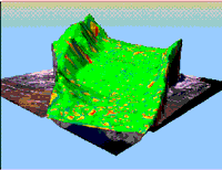
DEM reliability
green-high
red - low

A. Glazovsky*, Yu. Macheret*, F. Navarro**, E. Vasilenko***
*Institute of Geography RAS, Moscow, ** Polythechnical University, Madrid, *** Akadempribor, Tashkent
General
Aldegondabreen is a glacier on Svalbard, nearby the Barentsburg settlement.
Radiophysical studies were conducted there in April - May 1999 using a monopulse radar VIRL-2 with central frequency 40 MHz and a new digital recording and indication system (DRIS). The equipment allows to record simultaneously the radar-tracking information and additional georeference data from GPS and odometer with an interval from 1 up to 99 s in movement or in constant position.